![](/images/other/stat-length.png)
![Tocht Stappen Rocchetta Nervina - Rocchetta Nervina - Rio Barbeira - Ponte Cin - Photo](https://media.geolcdn.com/t/1900/400/ext.pjpeg?maxdim=2&url=https%3A%2F%2Fstatic1.geolcdn.com%2Fsiteimages%2Fupload%2Ffiles%2F1553511878bg_sport_marche.png)
Rocchetta Nervina - Rio Barbeira - Ponte Cin
erikr
Gebruiker
![Lengte](/images/other/stat-length.png)
Lengte
5,4 km
![Max. hoogte](https://static1.geolcdn.com/siteimages/upload/files/1508320355ic_sort_altitude_max_24dp.png)
Max. hoogte
473 m
![Positief hoogteverschil](https://static1.geolcdn.com/siteimages/upload/files/1508320355ic_sort_den_pos_24dp.png)
Positief hoogteverschil
274 m
![Km-Effort](/images/other/stat-length.png)
Km-Effort
9,1 km
![Min. hoogte](https://static1.geolcdn.com/siteimages/upload/files/1508320355ic_sort_altitude_min_24dp.png)
Min. hoogte
224 m
![Negatief hoogteverschil](https://static1.geolcdn.com/siteimages/upload/files/1508320355ic_sort_den_neg_24dp.png)
Negatief hoogteverschil
293 m
![Boucle](https://static1.geolcdn.com/siteimages/upload/files/16400158638029165_repeat_loop_refresh_sync_direction_icon.png)
Boucle
Ja
Datum van aanmaak :
2017-04-07 00:00:00.0
Laatste wijziging :
2017-04-07 00:00:00.0
![Stappen](https://static1.geolcdn.com/sitytour/trail-icons/101.png)
2h05
Moeilijkheid : Gemakkelijk
![Scan deze QR-code om de tocht te openen in de SityTrail-applicatie](https://capi.geolives.com/qq0zvz2zws4bq2lad0pu/sitytour/trails/728532/qr.png?size=200)
Gratisgps-wandelapplicatie
Over ons
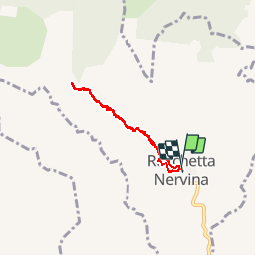
Tocht Stappen van 5,4 km beschikbaar op Ligurië, Imperia, Rocchetta Nervina. Deze tocht wordt voorgesteld door erikr.
Beschrijving
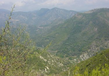
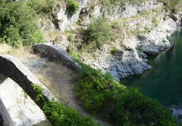
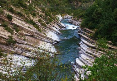
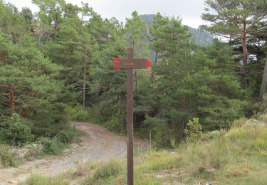
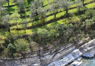
Départ au village et remontée du Canyon du Rio Barbeira jusqu'au ponte Cin, puis retour. A la descente ne pas rater la traversée de l'autre côté du rio pour profiter de superbes points au abords de l'eau.
Plaatsbepaling
Land:
Italy
Regio :
Ligurië
Departement/Provincie :
Imperia
Gemeente :
Rocchetta Nervina
Locatie:
Unknown
Vertrek:(Dec)
Vertrek:(UTM)
387517 ; 4860727 (32T) N.
Opmerkingen
Wandeltochten in de omgeving
![Tocht Te voet Airole - Traversée Airole-Breil - Photo](https://media.geolcdn.com/t/375/260/ext.jpg?maxdim=2&url=https%3A%2F%2Fmedia.geolcdn.com%2Ff%2F62b54dcb-d617-407a-81a2-9f5c93e8261f.jpeg)
![Te voet Te voet](https://static1.geolcdn.com/sitytour/trail-icons/100.png)
Traversée Airole-Breil
Te voet
Medium
Airole,
Ligurië,
Imperia,
Italy
![](/images/other/stat-length.png)
12,7 km | 20 km-effort
4h 33min
![](https://static1.geolcdn.com/siteimages/upload/files/16400158638029165_repeat_loop_refresh_sync_direction_icon.png)
Neen
![Tocht Te voet Airole - Anello del Gramondo - Photo](https://media.geolcdn.com/t/375/260/ext.jpg?maxdim=2&url=https%3A%2F%2Fmedia.geolcdn.com%2Ff%2Fa83852fd-a46b-4921-bf67-5c05a5b0232d.jpeg)
![Te voet Te voet](https://static1.geolcdn.com/sitytour/trail-icons/100.png)
Anello del Gramondo
Te voet
Gemakkelijk
Airole,
Ligurië,
Imperia,
Italy
![](/images/other/stat-length.png)
5 km | 7,9 km-effort
1h 47min
![](https://static1.geolcdn.com/siteimages/upload/files/16400158638029165_repeat_loop_refresh_sync_direction_icon.png)
Neen
![Tocht Te voet Airole - Anello del Gramondo - Photo](https://media.geolcdn.com/t/375/260/ext.jpg?maxdim=2&url=https%3A%2F%2Fmedia.geolcdn.com%2Ff%2F9fe7e0b5-8198-4662-8b3c-f48a75f07d69.jpeg)
![Te voet Te voet](https://static1.geolcdn.com/sitytour/trail-icons/100.png)
Anello del Gramondo
Te voet
Moeilijk
Airole,
Ligurië,
Imperia,
Italy
![](/images/other/stat-length.png)
22 km | 40 km-effort
8h 59min
![](https://static1.geolcdn.com/siteimages/upload/files/16400158638029165_repeat_loop_refresh_sync_direction_icon.png)
Neen
![Tocht Te voet Airole - Anello del Colombin - Photo](https://media.geolcdn.com/t/375/260/ext.jpg?maxdim=2&url=https%3A%2F%2Fmedia.geolcdn.com%2Ff%2F16914238-78f2-4214-b920-a884aa69e150.jpeg)
![Te voet Te voet](https://static1.geolcdn.com/sitytour/trail-icons/100.png)
Anello del Colombin
Te voet
Gemakkelijk
Airole,
Ligurië,
Imperia,
Italy
![](/images/other/stat-length.png)
6,4 km | 9,8 km-effort
2h 13min
![](https://static1.geolcdn.com/siteimages/upload/files/16400158638029165_repeat_loop_refresh_sync_direction_icon.png)
Neen
![Tocht Te voet Rocchetta Nervina - Rocchetta Nervina - Fontana Povera - Photo](https://media.geolcdn.com/t/375/260/ext.jpg?maxdim=2&url=https%3A%2F%2Fmedia.geolcdn.com%2Ff%2F08f7f251-bcba-4dd2-a02f-5b0d0bce6104.jpeg)
![Te voet Te voet](https://static1.geolcdn.com/sitytour/trail-icons/100.png)
Rocchetta Nervina - Fontana Povera
Te voet
Gemakkelijk
Rocchetta Nervina,
Ligurië,
Imperia,
Italy
![](/images/other/stat-length.png)
5,6 km | 15 km-effort
3h 25min
![](https://static1.geolcdn.com/siteimages/upload/files/16400158638029165_repeat_loop_refresh_sync_direction_icon.png)
Neen
![Tocht Te voet Airole - Airole - Fanghetto - Photo](https://media.geolcdn.com/t/375/260/ext.jpg?maxdim=2&url=https%3A%2F%2Fmedia.geolcdn.com%2Ff%2F9b3dde22-a67f-4961-966d-277bc192618b.jpeg)
![Te voet Te voet](https://static1.geolcdn.com/sitytour/trail-icons/100.png)
Airole - Fanghetto
Te voet
Gemakkelijk
Airole,
Ligurië,
Imperia,
Italy
![](/images/other/stat-length.png)
3,7 km | 5,7 km-effort
1h 17min
![](https://static1.geolcdn.com/siteimages/upload/files/16400158638029165_repeat_loop_refresh_sync_direction_icon.png)
Neen
![Tocht Te voet Airole - Sentiero Balcone Mediterraneo T2 - Photo](https://media.geolcdn.com/t/375/260/ext.jpg?maxdim=2&url=https%3A%2F%2Fmedia.geolcdn.com%2Ff%2F16914238-78f2-4214-b920-a884aa69e150.jpeg)
![Te voet Te voet](https://static1.geolcdn.com/sitytour/trail-icons/100.png)
Sentiero Balcone Mediterraneo T2
Te voet
Medium
Airole,
Ligurië,
Imperia,
Italy
![](/images/other/stat-length.png)
14,7 km | 26 km-effort
5h 49min
![](https://static1.geolcdn.com/siteimages/upload/files/16400158638029165_repeat_loop_refresh_sync_direction_icon.png)
Neen
![Tocht Te voet Dolceacqua - La Colla - Colla Sgora - Photo](https://media.geolcdn.com/t/375/260/ext.jpg?maxdim=2&url=https%3A%2F%2Fmedia.geolcdn.com%2Ff%2Fb72f9800-410f-467b-95db-69956a32b123.jpeg)
![Te voet Te voet](https://static1.geolcdn.com/sitytour/trail-icons/100.png)
La Colla - Colla Sgora
Te voet
Gemakkelijk
Dolceacqua,
Ligurië,
Imperia,
Italy
![](/images/other/stat-length.png)
9,5 km | 16,3 km-effort
3h 42min
![](https://static1.geolcdn.com/siteimages/upload/files/16400158638029165_repeat_loop_refresh_sync_direction_icon.png)
Neen
![Tocht Stappen Airole - Airole à Breil sur Roya - Photo](https://media.geolcdn.com/t/375/260/ext.jpg?maxdim=2&url=https%3A%2F%2Fmedia.geolcdn.com%2Ff%2Fc88d8463-3ac5-4a45-8828-418bfec5bf3c.JPG)
![Stappen Stappen](https://static1.geolcdn.com/sitytour/trail-icons/101.png)
Airole à Breil sur Roya
Stappen
Medium
Airole,
Ligurië,
Imperia,
Italy
![](/images/other/stat-length.png)
14 km | 22 km-effort
6h 42min
![](https://static1.geolcdn.com/siteimages/upload/files/16400158638029165_repeat_loop_refresh_sync_direction_icon.png)
Neen